Ontario's Historical Plaques
at ontarioplaques.com
Learn a little Ontario history as told through its plaques
Founding of New Liskeard
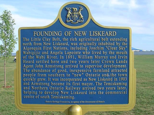
Photo by contributor Cliff Thornton - Posted August, 2005
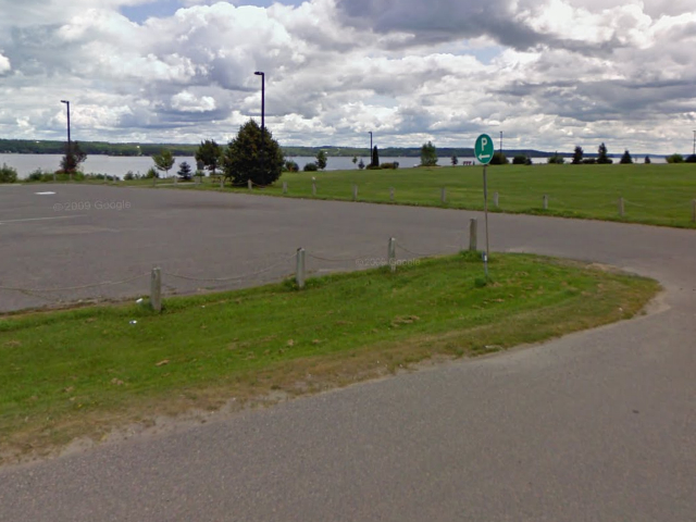
Photo from Google Street View ©2010 Google - Posted October, 2010
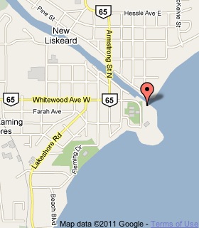
Plaque Location
The District of Timiskaming
The City of Temiskaming Shores
In New Liskeard, at the foot of Whitewood Avenue
beside a parking lot, near the river's shore
Coordinates: N 47 30.485 W 79 40.024 |
 |
Plaque Text
The Little Clay Belt, the rich agricultural belt extending north from New Liskeard, was originally inhabited by the Algonquin First Nations, including Joachim "Clear Sky" Wabigijic and Angela Lapointe who lived by the mouth of the Wabi River. In 1891, William Murray and Irvin Heard settled here and two years later Crown Lands Agent John Armstrong arrived to supervise development. The abundance of good, inexpensive farmland attracted people from southern to "new" Ontario and the town quickly grew. It was incorporated as New Liskeard in 1903 and Armstrong became its first mayor. The Temiskaming and Northern Ontario Railway arrived two years later, helping to develop New Liskeard into the commercial centre of south Timiskaming.
More
Information
More
Settlements
More towns and cities in the District of Timiskaming
Englehart
Latchford
Swastika
Here are the visitors' comments for this page.
(none yet)
Here's where you can write a comment for this page.
Note: If you wish to ask me a question, please use the email link in the menu.
Note: Comments are moderated. Yours will appear on this page within 24 hours
(usually much sooner).
Note: As soon as the comment is posted, a link to it will appear on the home page in the section "Here are the 10 latest plaque pages with a new comment added by a visitor to this site."