Ontario's Historical Plaques
at ontarioplaques.com
Learn a little Ontario history as told through its plaques
Founding of Englehart
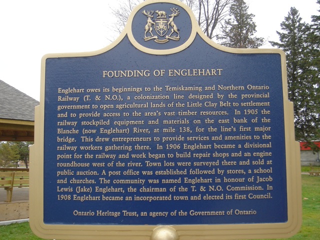
Photo by contributor Blair Olsen - November, 2008
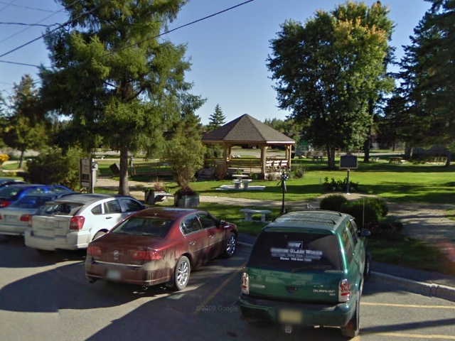
Photo from Google Street View ©2010 Google - Posted October, 2010
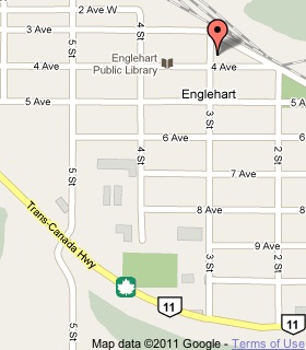
Plaque Location
The District of Timiskaming
The Town of Englehart
In Centennial Park, at the northeast corner of
Third Street and Fourth Avenue
Coordinates: N 47 49.548 W 79 52.374 |
 |
Plaque Text
Englehart owes its beginnings to the Temiskaming and Northern Ontario Railway (T. & N.O.), a colonization line designed by the provincial government to open agricultural lands of the Little Clay Belt to settlement and to provide access to the area's vast timber resources. In 1905 the railway stockpiled equipment and materials on the east bank of the Blanche (now Englehart) River, at mile 138, for the line's first major bridge. This drew entrepreneurs to provide services and amenities to the railway workers gathering there. In 1906 Englehart became a divisional point for the railway and work began to build repair shops and an engine roundhouse west of the river. Town lots were surveyed there and sold at public auction. A post office was established followed by stores, a school and churches. The community was named Englehart in honour of Jacob Lewis (Jake) Englehart, the chairman of the T. & N.O. Commission. In 1908 Englehart became an incorporated town and elected its first Council.
More
Information
More
Settlements
Here are the visitors' comments for this page.
Posted February 22, 2009
I live in Englehart and I love it!!
Here's where you can write a comment for this page.
Note: If you wish to ask me a question, please use the email link in the menu.
Note: Comments are moderated. Yours will appear on this page within 24 hours
(usually much sooner).