Discover Ontario's history as told through its plaques
2004 - Now in our 15th Year - 2019
To find out all about me, you can visit the Home Page
Looking at this page on a smartphone?
For best viewing, hold your phone
in Landscape mode (Horizontal)
Champlain's Astrolabe

Photo by contributor Albert Joseph - Posted August, 2011

Photo by contributor Brian Bockus - Posted May, 2017
Plaque Location
The County of Renfrew
The Township of Whitewater Region
On Highway 17 at a pull off on the east side of the highway
4.2 km south of the intersection of
Highway 17 and Main Street (Road 8) in Cobden
Coordinates: N 45 35.933 W 76 50.666 |
 |
Plaque Text
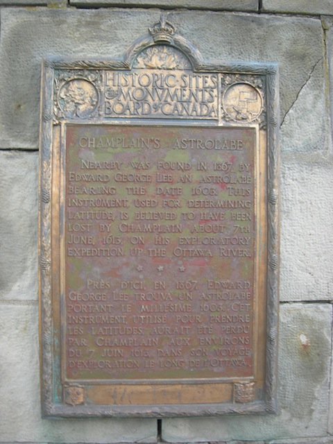
Nearby was found in 1867 by Edward George Lee an astrolabe bearing the date 1603. This instrument, used for determining latitude, is believed to have been lost by Champlain about 7th June, 1613, on his exploratory expedition up the Ottawa River.
Related Ontario plaques
Champlain in Ontario, 1615
Champlain's Journey of 1613
Champlain's War Party, 1615
Samuel de Champlain (died in 1635)
Gateway to Huronia
Related Toronto plaque
Samuel de Champlain's Journeys Through Ontario
More
Information
More
Explorers
Here are the visitors' comments for this page.
> Posted July 5, 2014
My grandfather Edward Mau and father Allan Mau constructed this monument circa 1950 when my father was about 13 years old.
> Posted August 29, 2012
Thanks for providing the image of the astrolabe monument, a great part of Canadian history.
Here's where you can send me a comment for this page.
Note: Your email address will be posted at the end of your comment so others can respond to you unless you request otherwise.
Note: Comments are moderated. Yours will appear on this page within 24 hours (usually much sooner).
Note: As soon as I have posted your comment, a reply to your email will be sent informing you.
To send me your comment, click .
Thanks
Alan L Brown
Webmaster
Note: If you wish to send me a personal email, click .