Discover Ontario's history as told through its plaques
2004 - Now in our 15th Year - 2019
To find out all about me, you can visit the Home Page
Looking at this page on a smartphone?
For best viewing, hold your phone
in Landscape mode (Horizontal)
The Monck Road
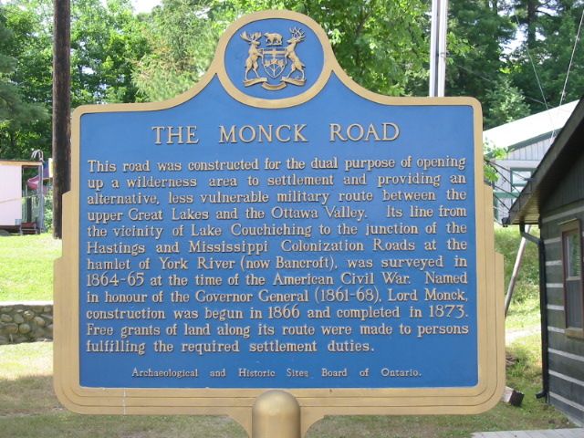
Photo by Alan L Brown - Posted July, 2005
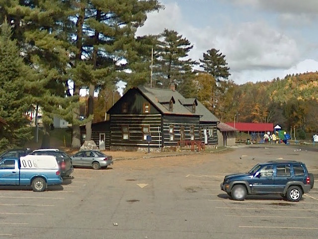
Photo from Google Street View ©2015 Google - Posted February, 2015
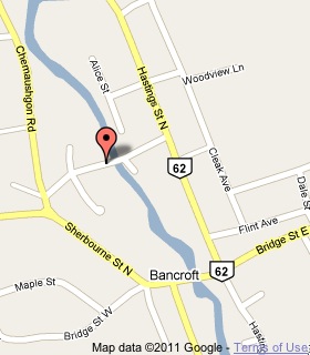
Plaque Location
The County of Hastings
The Town of Bancroft
In front of a museum on the north side of Station Street
just west of the York River bridge
Coordinates: N 45 03.545 W 77 51.455 |
 |
Plaque Text
This road was constructed for the dual purpose of opening up a wilderness area to settlement and providing an alternative, less vulnerable military route between the upper Great Lakes and the Ottawa Valley. Its line from the vicinity of Lake Couchiching to the junction of the Hastings and Mississippi Colonization Roads at the hamlet of York River (now Bancroft), was surveyed in 1864-65 at the time of the American Civil War. Named in honour of the Governor General (1861-68), Lord Monck, construction was begun in 1866 and completed in 1873. Free grants of land along its route were made to persons fulfilling the required settlement duties.
Related Ontario plaque
Sir Charles Stanley Monck 1819-1894
More
Information
More
Roads
Here are the visitors' comments for this page.
(none yet)
Here's where you can send me a comment for this page.
Note: Your email address will be posted at the end of your comment so others can respond to you unless you request otherwise.
Note: Comments are moderated. Yours will appear on this page within 24 hours (usually much sooner).
Note: As soon as I have posted your comment, a reply to your email will be sent informing you.
To send me your comment, click .
Thanks
Alan L Brown
Webmaster
Note: If you wish to send me a personal email, click .