Ontario's Historical Plaques
at ontarioplaques.com
Learn a little Ontario history as told through its plaques
Fort Kaministiquia 1717
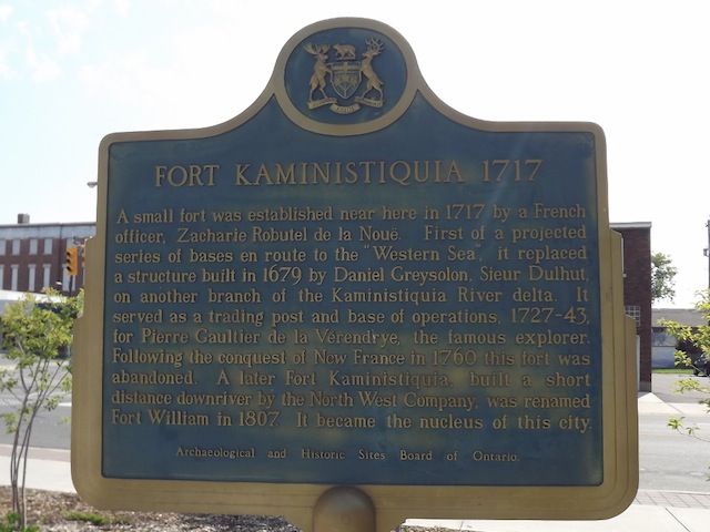
Photo by contributor Dave Fernie - Posted October, 2005
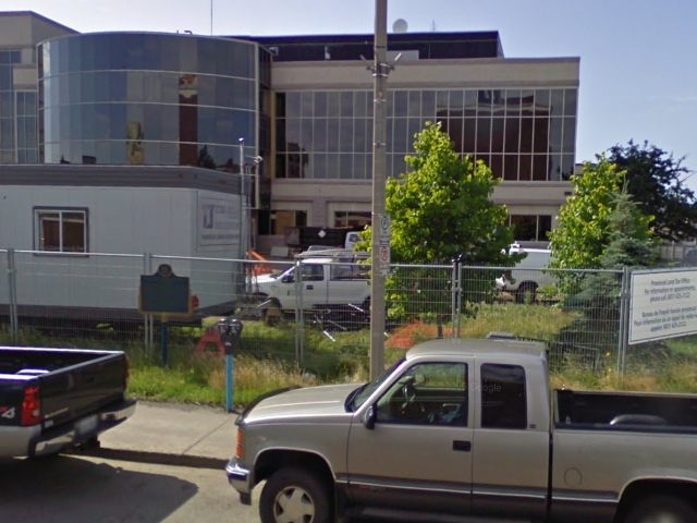
Photo from Google Street View ©2010 Google - Posted October, 2010
Plaque Location
The District of Thunder Bay
The City of Thunder Bay
At the city hall, on the southeast corner of
Donald Street East and Brodie Street South
Coordinates: N 48 22.947 W 89 14.780 |
 |
Plaque Text
A small fort was established near here in 1717 by a French officer, Zacharie Robutel de la Nouë. First of a projected series of bases en route to the "Western Sea", it replaced a structure built in 1679 by Daniel Greysolon, Sieur Dulhut, on another branch of the Kaministiquia River delta. It served as a trading post and base of operations, 1727-43, for Pierre Gaultier de la Vérendrye, the famous explorer. Following the conquest of New France in 1760 this fort was abandoned. A later Fort Kaministiquia, built a short distance downriver by the North West Company, was renamed Fort William in 1807. It became the nucleus of this city.
Related Ontario plaques
Sieur de La Vérendrye 1685-1749
The North West Company
Fort William
The Capture of Fort William
More
Information
More
Trading Posts
Here are the visitors' comments for this page.
Posted December 10, 2010
The Historical Plaque, is not at Fort William Historical Park, it is in front of the Thunder Bay City Hall, beside the historical plaque doe William McGillivary. The plaques are actually much closer to the original site of Fort William then the Historical Park is, but you should totally visit FWHP its an awesome historical site
Here's where you can write a comment for this page.
Note: If you wish to ask me a question, please use the email link in the menu.
Note: Comments are moderated. Yours will appear on this page within 24 hours
(usually much sooner).