Ontario's Provincial Plaques
Here's where you can learn a little Ontario history.
Henry Wolsey Bayfield 1795-1885
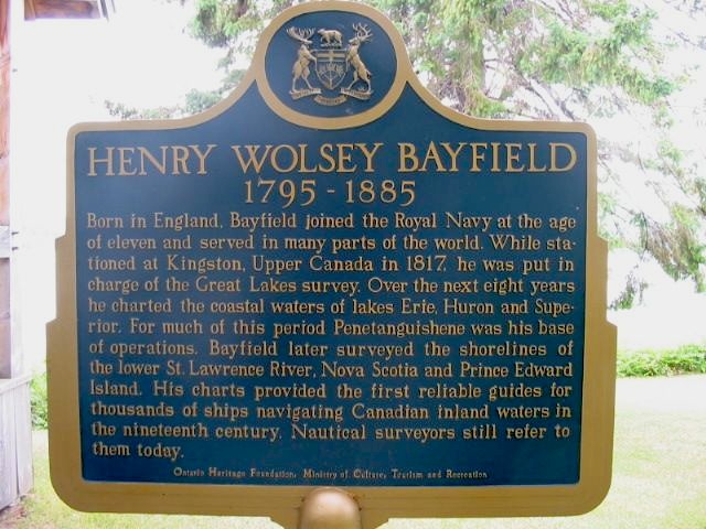
Photo by Alan L Brown - July 17, 2004
Plaque Location
The County of Simcoe
The Town of Penetanguishene
In the paid admission area of Discovery Harbour, on the left side of the pathway at Bayfield's Point of View exhibit.
Plaque Text
Born in England, Bayfield joined the Royal Navy at the age of eleven and served in many parts of the world. While stationed at Kingston, Upper Canada in 1817, he was put in charge of the Great Lakes survey. Over the next eight years he charted the costal waters of lakes Erie, Huron and Superior. For much of this period Penetanguishene was his base of operations. Bayfield later surveyed the shorelines of the lower St. Lawrence River, Nova Scotia and Prince Edward Island. His charts provided the first reliable guides for thousands of ships navigating Canadian inland waters in the nineteenth century. Nautical surveyors still refer to them today.
Here are the comments for this page.
(none yet)
Write a comment for this page.
(Note: If you wish to ask me a question, please use the email link in the menu.)
Note: Comments are moderated. Yours will appear on this page within 24 hours (usually much sooner).