Ontario's Historical Plaques
at ontarioplaques.com
Learn a little Ontario history as told through its plaques
The Pembroke and Mattawan Road
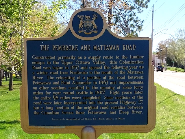
Photo by Alan L Brown - Posted July, 2005
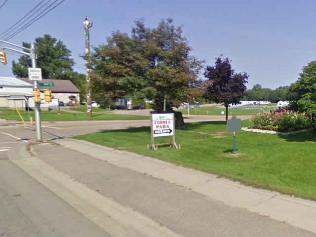
Photo from Google Street View ©2011 Google - Posted January, 2011
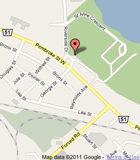
Plaque Location
The County of Renfrew
The City of Pembroke
In a park on the north side of Pembroke Street West
across from George Street
Coordinates: N 45 49.817 W 77 08.287 |
 |
Plaque Text
Constructed primarily as a supply route to the lumber camps in the Upper Ottawa Valley, this Colonization Road was begun in 1853 and opened the following year as a winter road from Pembroke to the mouth of the Mattawa River. The relocating of a portion of the road between Petawawa and Point Alexander in 1863 and improvements on other sections resulted in the opening of some 64 km for year round traffic in 1867. Eight years later the entire 158 km were completed. Some sections of the road were later incorporated into the present Highway 17, but a long section of the original road remains between the Canadian Forces Base Petawawa and Deep River.
More
Roads
Here are the visitors' comments for this page.
Posted February 20, 2010
any maps of this route from pembroke to mattawa river. if so where to get them
Here's where you can write a comment for this page.
Note: If you wish to ask me a question, please use the email link in the menu.
Note: Comments are moderated. Yours will appear on this page within 24 hours
(usually much sooner).
Note: As soon as the comment is posted, a link to it will appear on the home page in the section "Here are the 10 latest plaque pages with a new comment added by a visitor to this site."