Ontario's Historical Plaques
at ontarioplaques.com
Learn a little Ontario history as told through its plaques
Kay-Nah-Chi-Wah-Nung
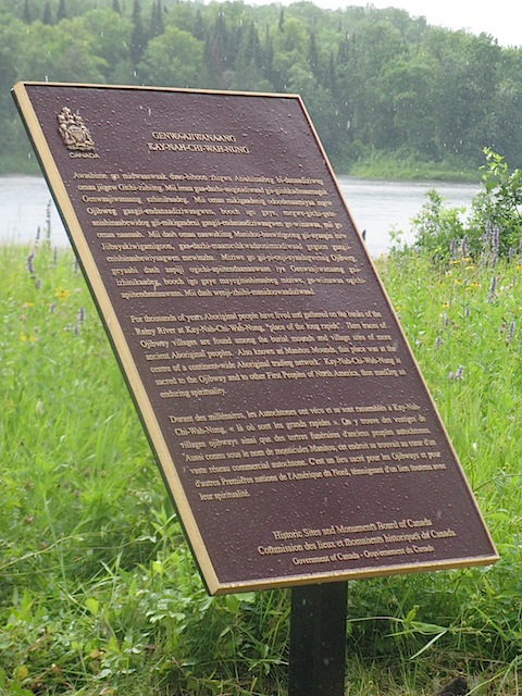
Photo courtesy of Parks Canada - January, 2011
Photo from Google Maps ©2011 Google - January, 2011
Plaque Location
The District of Rainy River
The Township of Morley
At the Visitor Centre at Kay-Nah-Chi-Wah-Nung
8 km east and south of Stratton
(on Highway 11 at Road 617, 20 km west of Highway 71)
via 3.4 km east on Highway 11, 2.9 km south on Shaw Road
then 1.7 km east on River Road
Coordinates: N 48 38.816 W 94 05.641 |
Plaque Text
(transcribed by Wayne Adam)
For thousands of years Aboriginal people have lived and gathered on the banks of the Rainy River at Kay-Nah-Chi-Wah-Nung, "place of the long rapids". Here traces of Ojibway villages are found among the burial mounds and village sites of more ancient Aboriginal peoples. Also known as Manitou Mounds, this place was at the centre of an continent-wide Aboriginal trading network. Kay-Nah-Chi-Wah-Nung is sacred to the Ojibway and to other First Peoples of North America, thus marking an enduring spirituality.
More
Information
Here are the comments for this page.
(none yet)
Here's where you can write a comment for this page.
Note: If you wish to ask me a question, please use the email link in the menu.
Note: Comments are moderated. Yours will appear on this page within 24 hours
(usually much sooner).