Ontario's Historical Plaques
at ontarioplaques.com
Learn a little Ontario history as told through its plaques
Fort De Levis
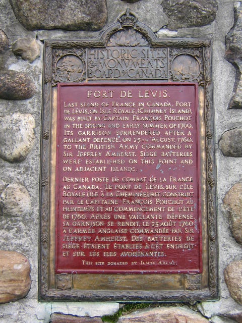
Photo by Alan L Brown - Posted May, 2009
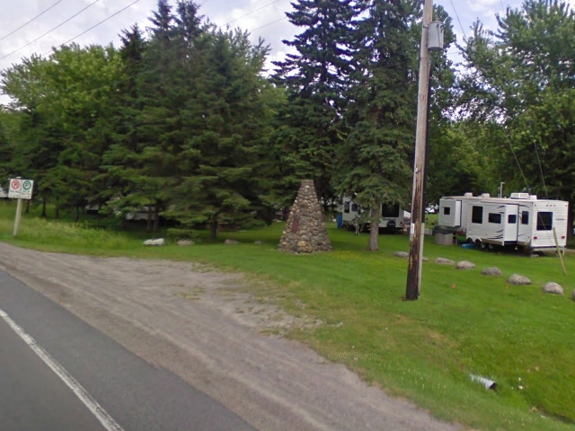
Photo from Google Street View ©2010 Google - Posted December, 2010
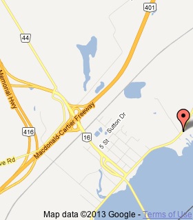
Plaque Location
The County of Leeds and Grenville
The Township of Edwardsburgh/Cardinal
On the south side of Road 2
1.4 km east of Highway 16 in Johnston
Coordinates: N 44 45.119 W 75 27.109 |
 |
Plaque Text
Last stand of France in Canada. Fort de Lévis, on Isle Royale, (Chimney Island) was built by Captain François Pouchot in the spring and early summer of 1760. Its garrison surrendered after a gallant defence, on 25th August, 1760, to the British army commanded by Sir Jeffrey Amherst. Siege batteries were established on this point and on adjacent islands.
More
Forts and Other Military Places
Here are the visitors' comments for this page.
(none yet)
Here's where you can write a comment for this page.
Note: If you wish to ask me a question, please use the email link in the menu.
Note: Comments are moderated. Yours will appear on this page within 24 hours
(usually much sooner).