Ontario's Historical Plaques
at ontarioplaques.com
Learn a little Ontario history as told through its plaques
The Durham Road
Photos by contributor Guusje Litjens - Posted July, 2010
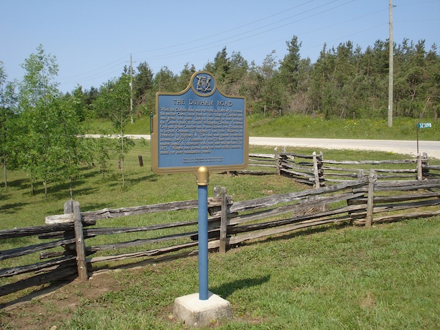
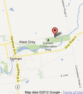
Plaque Location
The County of Grey
The Township of West Grey
At the entrance to Durham Conservation Area on Grey Road 27
Coordinates: N 44 11.074 W 80 47.757 |
 |
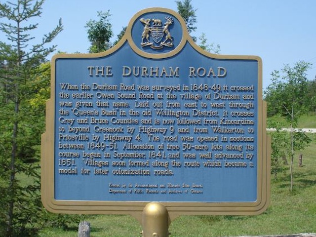
Plaque Text
When the Durham Road was surveyed in 1848-49, it crossed the earlier Owen Sound Road at the village of Durham and was given that name. Laid out from east to west through the "Queen's Bush" in the old Wellington District, it crosses Grey and Bruce Counties and is now followed from Kincardine to beyond Greenock by Highway 9 and from Walkerton to Priceville by Highway 4. The road was opened in sections between 1849-51. Allocation of free 20 ha lots along its course began in September, 1841, and was well advanced by 1851. Villages soon formed along the route which became a model for later colonization roads.
Related Ontario plaques
The Queen's Bush Settlement, 1820-1867
Founding of Durham
The Founding of Hanover
The Founding of Walkerton
More
Roads
Here are the visitors' comments for this page.
(none yet)
Here's where you can write a comment for this page.
Note: If you wish to ask me a question, please use the email link in the menu.
Note: Comments are moderated. Yours will appear on this page within 24 hours
(usually much sooner).
Note: As soon as the comment is posted, a link to it will appear on the home page in the section "Here are the 10 latest plaque pages with a new comment added by a visitor to this site."
* Temporary Note: Due to my absence from my computer on August 24, 25 and 26, 2012, all comments sent on those days will not be posted until the 27th.