Discover Ontario's history as told through its plaques
2004 - Now in our 13th Year - 2017
To see what's new on this site, you can visit the Home Page
Looking at this page on a smartphone?
For best viewing, hold your phone
in Landscape mode (Horizontal)
Yonge Street
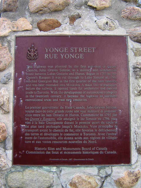
Photo by Alan L Brown - Posted May, 2009
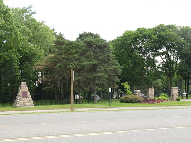
Photo by contributor Wayne Adam - Posted September, 2011
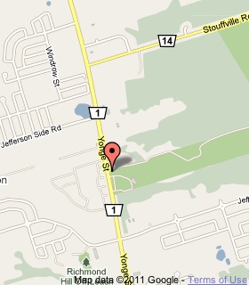
Plaque Location
The Region of York
The Town of Richmond Hill
On the east side of Yonge Street, south of Jefferson Sideroad,
at the entrance to the Summit Golf and Country Club
Coordinates: N 43 55.123 W 79 26.889 |
 |
Plaque Text
This highway was planned by the first governor of Upper Canada, John Graves Simcoe, as a military and commercial route between Lakes Ontario and Huron. Begun in 1795 by the Queen's Rangers it was cut through to Lake Simcoe in 1796, reached Georgian Bay in the first quarter of the next century, and was later extended into Muskoka. A main line of transport before the railway, it opened lands for settlement and carried trade to Toronto. With the development of automotive transport in the twentieth century, it became the highway to northern recreational areas and vast new resources.
Related Ontario plaques
The Ferguson Highway
John Graves Simcoe 1752-1806
Related Toronto plaques
Yonge Street 1796
The Queen's Rangers
More
Information
More
Roads
Here are the visitors' comments for this page.
(none yet)
Here's where you can sent me a comment for this page.
Note: Your email address will be posted at the end of your comment so others can respond to you unless you request otherwise.
Note: Comments are moderated. Yours will appear on this page within 24 hours (usually much sooner).
Note: As soon as I have posted your comment, a reply to your email will be sent informing you.
To send me your comment, click .
Thanks
Alan L Brown
Webmaster
Note: If you wish to send me a personal email, click .