Discover Ontario's history as told through its plaques
2004 - Now in our 15th Year - 2019
To find out all about me, you can visit the Home Page
Looking at this page on a smartphone?
For best viewing, hold your phone
in Landscape mode (Horizontal)
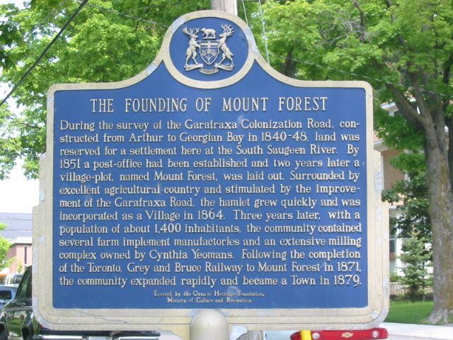
The Founding of Mount Forest

Photo by Alan L Brown - Posted June, 2004

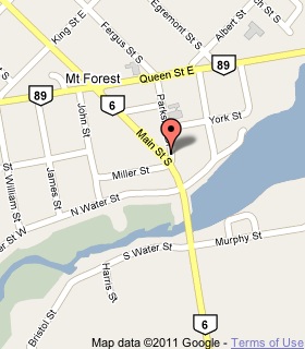
Photo from Google Street View ©2011 Google - Posted January, 2011
Plaque Location
The County of Wellington
The Township of Wellington North
In Mount Forest, on the northeast corner of
Main Street and Parkside Drive, at the south end of town
Coordinates: N 43 58.648 W 80 43.747 |
 |
Plaque Text
During the survey of the Garafraxa Colonization Road, constructed from Arthur to Georgian Bay in 1840-48, land was reserved for a settlement here at the South Saugeen River. By 1851 a post-office had been established and two years later a village-plot, named Mount Forest, was laid out. Surrounded by excellent agricultural country and stimulated by the improvement of the Garafraxa Road, the hamlet grew quickly and was incorporated as a Village in 1864. Three years later, with a population of about 1400 inhabitants, the community contained several farm implement manufactories and an extensive milling complex owned by Cynthia Yeomans. Following the completion of the Toronto, Grey and Bruce Railway to Mount Forest in 1871, the community expanded rapidly and became a Town in 1879.
Related Ontario plaque
Toronto, Grey and Bruce Railway
More
Information
More
Settlements
Here are the visitors' comments for this page.
(none yet)
Here's where you can send me a comment for this page.
Note: Your email address will be posted at the end of your comment so others can respond to you unless you request otherwise.
Note: Comments are moderated. Yours will appear on this page within 24 hours (usually much sooner).
Note: As soon as I have posted your comment, a reply to your email will be sent informing you.
To send me your comment, click .
Thanks
Alan L Brown
Webmaster
Note: If you wish to send me a personal email, click .