Discover Ontario's history as told through its plaques
2004 - Now in our 15th Year - 2019
To find out all about me, you can visit the Home Page
Looking at this page on a smartphone?
For best viewing, hold your phone
in Landscape mode (Horizontal)
Scott's Mills 1820
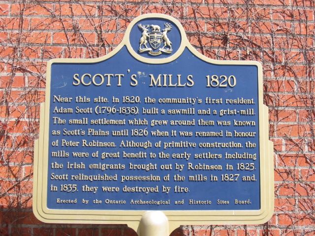
Photo by Alan L Brown - Posted December, 2010
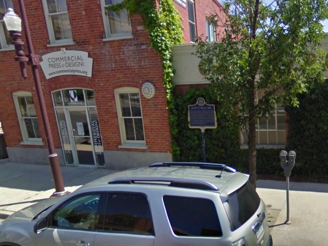
Photo from Google Street View ©2011 Google - Posted January, 2011
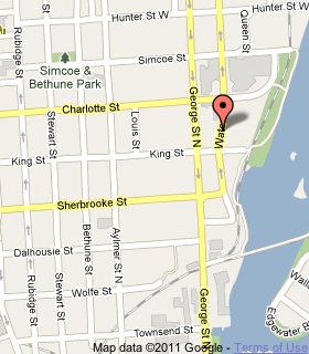
Plaque Location
The County of Peterborough
The City of Peterborough
On the east side of Water Street between
Charlotte Street and King Street
Coordinates: N 44 18.155 W 78 19.131 |
 |
Plaque Text
Near this site, in 1820, the community's first resident Adam Scott (1796-1838), built a sawmill and grist-mill. The small settlement which grew around them was known as Scott's Plains until 1826 when it was renamed in honour of Peter Robinson. Although of primitive construction, the mills were of great benefit to the early settlers including the Irish emigrants brought out by Robinson in 1825. Scott relinquished possession of the mills in 1827 and, in 1835, they were destroyed by fire.
Related Ontario plaque
The Robinson Settlement 1825
More
Mills
Here are the visitors' comments for this page.
(none yet)
Here's where you can send me a comment for this page.
Note: Your email address will be posted at the end of your comment so others can respond to you unless you request otherwise.
Note: Comments are moderated. Yours will appear on this page within 24 hours (usually much sooner).
Note: As soon as I have posted your comment, a reply to your email will be sent informing you.
To send me your comment, click .
Thanks
Alan L Brown
Webmaster
Note: If you wish to send me a personal email, click .