Discover Ontario's history as told through its plaques
2004 - Now in our 11th Year - 2015
To see what's new on this site, you can visit the Home Page
Looking at this page on a smartphone?
For best viewing, hold your phone
in Landscape mode (Horizontal)
Founding of Parry Sound
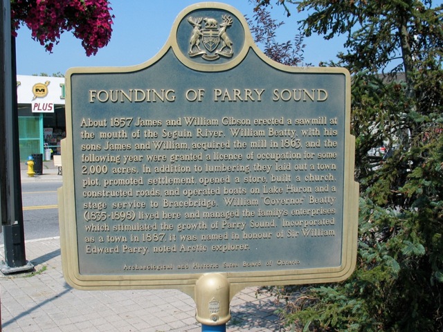
Photo by George Nassas - Posted June, 2009
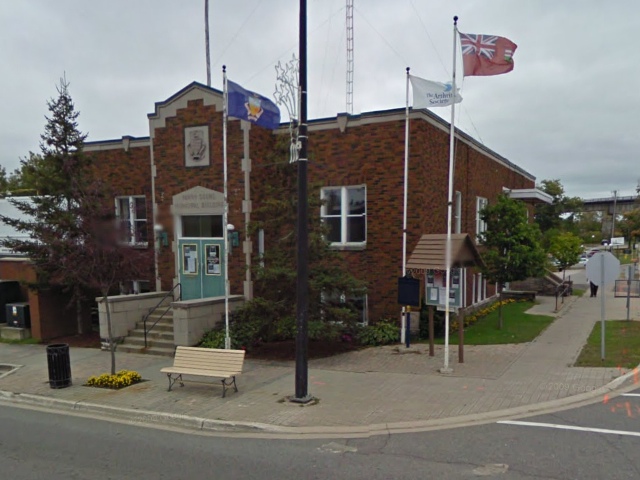
Photo from Google Street View ©2010 Google - Posted November, 2010
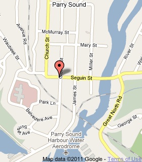
Plaque Location
The District of Parry Sound
The Town of Parry Sound
On the grounds of the municipal building
on the southeast corner of Seguin and Gibson streets
Coordinates: N 45 20.619 W 80 02.118 |
 |
Plaque Text
About 1857 James and William Gibson erected a sawmill at the mouth of the Seguin River. William Beatty, with his sons James and William, acquired the mill in 1863, and the following year were granted a licence of occupation for some 800 ha. In addition to lumbering, they laid out a town plot, promoted settlement, opened a store, built a church, constructed roads, and operated boats on Lake Huron and a stage service to Bracebridge. William "Governor" Beatty (1835-1898) lived here and managed the family's enterprises which stimulated the growth of Parry Sound. Incorporated as a town in 1887, it was named in honour of Sir William Edward Parry, noted Arctic explorer.
More
Information
More
Settlements
Here are the visitors' comments for this page.
(none yet)
Here's where you can sent me a comment for this page.
Note: If your comment includes a question, it's best to include your email address in your comment so others can respond to you.
Note: Comments are moderated. Yours will appear on this page within 24 hours (usually much sooner).
Note: As soon as I have posted your comment, a reply to your email will be sent informing you.
To send me your comment, click .
Thanks
Alan L Brown
Webmaster
Note: If you wish to send me a personal email, click .