Discover Ontario's history as told through its plaques
2004 - Now in our 15th Year - 2019
To find out all about me, you can visit the Home Page
Looking at this page on a smartphone?
For best viewing, hold your phone
in Landscape mode (Horizontal)
Lake Nipissing
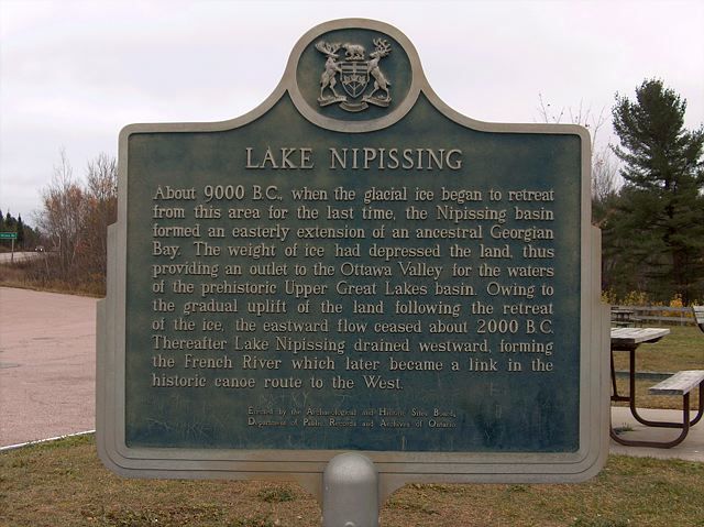
Photo by contributor Jamie Toeppner - Posted November, 2005
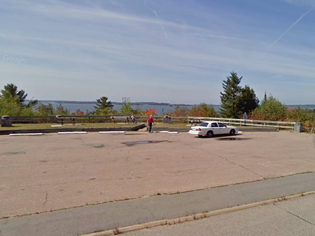
Photo from Google Street View ©2010 Google - Posted November, 2010
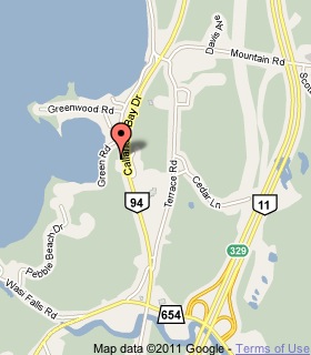
Plaque Location
The District of Parry Sound
The Municipality of Callander
At a parking lookout over the lake
on the west side of Callander Bay Drive
2.2 km south of the intersection of
Callander Bay Drive and Lansdowne Street
Coordinates: N 46 12.321 W 79 21.742 |
 |
Plaque Text
About 9000 B.C., when the glacial ice began to retreat from this area for the last time, the Nipissing basin formed an easterly extension of an ancestral Georgian Bay. The weight of ice had depressed the land, thus providing an outlet to the Ottawa Valley for the waters of the prehistoric Upper Great Lakes basin. Owing to the gradual uplift of the land following the retreat of the ice, the eastward flow ceased about 2000 B.C. Thereafter Lake Nipissing drained westward, forming the French River which later became a link in the historic canoe route to the West.
Related Ontario plaques
Canoe Route to the West
The Mattawa Route
More
Information
More
Lakes and Rivers
Here are the visitors' comments for this page.
(none yet)
Here's where you can send me a comment for this page.
Note: Your email address will be posted at the end of your comment so others can respond to you unless you request otherwise.
Note: Comments are moderated. Yours will appear on this page within 24 hours (usually much sooner).
Note: As soon as I have posted your comment, a reply to your email will be sent informing you.
To send me your comment, click .
Thanks
Alan L Brown
Webmaster
Note: If you wish to send me a personal email, click .