Discover Ontario's history as told through its plaques
2004 - Now in our 15th Year - 2019
To find out all about me, you can visit the Home Page
Looking at this page on a smartphone?
For best viewing, hold your phone
in Landscape mode (Horizontal)
Founders of Campbellford
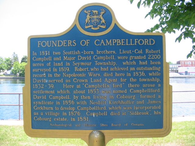
Photo by Alan L Brown - Posted July, 2005
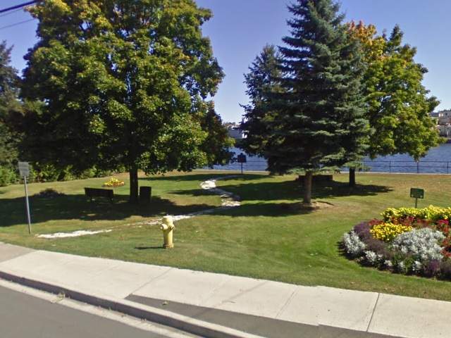
Photo from Google Street View ©2010 Google - Posted November, 2010
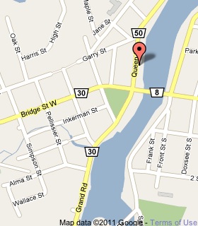
Plaque Location
The County of Northumberland
The Municipality of Trent Hills
In Campbellford, in a park
on the east side of Queen Street (Road 50)
just north of Bridge Street
Coordinates: N 44 18.571 W 77 47.995 |
 |
Plaque Text
In 1831 two Scottish-born brothers, Lieut.-Col. Robert Campbell and Major David Campbell, were granted 890 ha of land in Seymour Township, which had been surveyed in 1819. Robert who had achieved an outstanding record in the Napoleonic Wars, died here in 1836, while David served as Crown Land Agent for the Township, 1832-39. Here at "Campbell's ford" there arose a settlement which, about 1853, was named Campbellford. David Campbell, by then living in Cobourg, formed a syndicate in 1856 with Nesbitt Kirchhoffer and James Cockburn to develop Campbellford, which was incorporated as a village in 1876. Campbell died at "Sidbrook", his Cobourg estate, in 1881.
More
Information
More
Settlements
Here are the visitors' comments for this page.
(none yet)
Here's where you can send me a comment for this page.
Note: Your email address will be posted at the end of your comment so others can respond to you unless you request otherwise.
Note: Comments are moderated. Yours will appear on this page within 24 hours (usually much sooner).
Note: As soon as I have posted your comment, a reply to your email will be sent informing you.
To send me your comment, click .
Thanks
Alan L Brown
Webmaster
Note: If you wish to send me a personal email, click .