Discover Ontario's history as told through its plaques
2004 - Now in our 12th Year - 2016
To see what's new on this site, you can visit the Home Page
Looking at this page on a smartphone?
For best viewing, hold your phone
in Landscape mode (Horizontal)
Niagara Portage Road
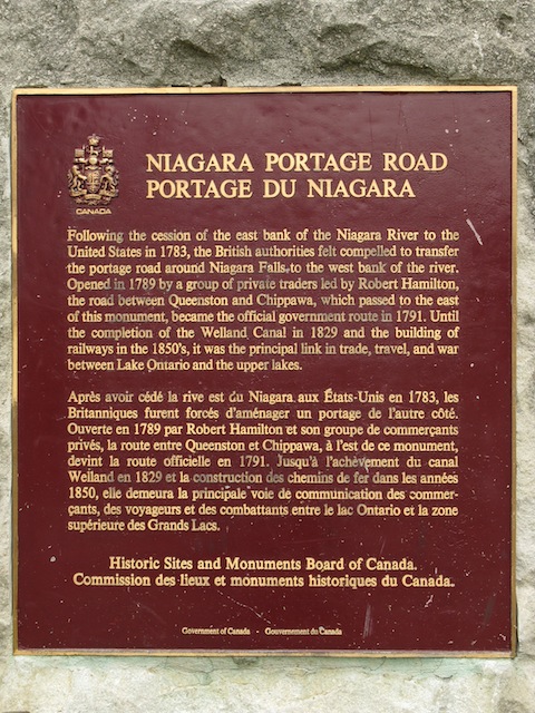
Photo by contributor Wayne Adam - Posted December, 2009
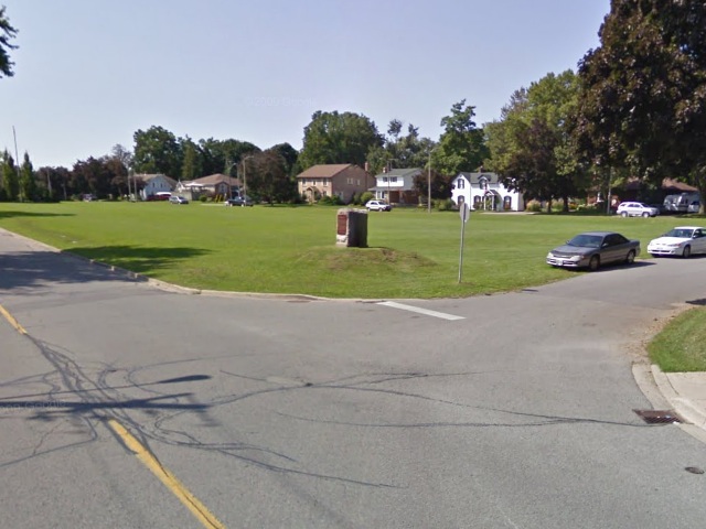
Photo from Google Street View ©2011 Google - Posted March, 2011
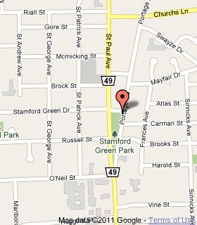
Plaque Location
The Region of Niagara
The City of Niagara Falls
At the southwest corner of Portage Road
and Stamford Green Drive
Coordinates: N 43 07.537 W 79 05.952 |
 |
Plaque Text
Following the cession of the east bank of the Niagara River to the United States in 1783, the British authorities felt compelled to transfer the portage road around Niagara Falls to the west bank of the river. Opened in 1789 by a group of private traders led by Robert Hamilton, the road between Queenston and Chippawa, which passed to the east of this monument, became the official government route in 1791. Until the completion of the Welland Canal in 1829 and the building of railways in the 1850's, it was the principal link in trade, travel, and war between Lake Ontario and the upper lakes.
Related Ontario plaque
First Welland Canal 1824-1833
More
Information
More
Roads
Here are the visitors' comments for this page.
(none yet)
Here's where you can sent me a comment for this page.
Note: Your email address will be posted at the end of your comment so others can respond to you unless you request otherwise.
Note: Comments are moderated. Yours will appear on this page within 24 hours (usually much sooner).
Note: As soon as I have posted your comment, a reply to your email will be sent informing you.
To send me your comment, click .
Thanks
Alan L Brown
Webmaster
Note: If you wish to send me a personal email, click .