Discover Ontario's history as told through its plaques
2004 - Now in our 12th Year - 2016
To see what's new on this site, you can visit the Home Page
Looking at this page on a smartphone?
For best viewing, hold your phone
in Landscape mode (Horizontal)
The Precambrian Shield
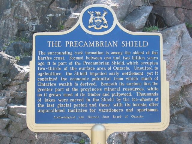
Photo by Alan L Brown - Posted May, 2005
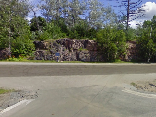
Photo from Google Street View ©2010 Google - Posted December, 2010
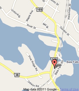
Plaque Location
The District of Muskoka
The Township of Muskoka Lakes
In Bala, in a parking lot south of the south bridge
on the east side of Road 169
Coordinates: N 45 00.684 W 79 36.876 |
 |
Plaque Text
The surrounding rock formation is among the oldest of the Earth's crust. Formed between one and two billion years ago, it is part of the Precambrian Shield, which occupies two-thirds of the surface area of Ontario. Unsuited to agriculture, the Shield impeded early settlement, yet it contained the economic potential from which much of Ontario's wealth is derived. Beneath its surface lies the greater part of the province's mineral resources, while on it grows most of its timber and pulpwood. Thousands of lakes were carved in the Shield by the ice-sheets of the last glacial period and these, with its forests, offer unparalleled facilities for vacationers and sportsmen.
More
Information
More
Landforms
Here are the visitors' comments for this page.
(none yet)
Here's where you can sent me a comment for this page.
Note: Your email address will be posted at the end of your comment so others can respond to you unless you request otherwise.
Note: Comments are moderated. Yours will appear on this page within 24 hours (usually much sooner).
Note: As soon as I have posted your comment, a reply to your email will be sent informing you.
To send me your comment, click .
Thanks
Alan L Brown
Webmaster
Note: If you wish to send me a personal email, click .