Discover Ontario's history as told through its plaques
2004 - Now in our 13th Year - 2017
To see what's new on this site, you can visit the Home Page
Looking at this page on a smartphone?
For best viewing, hold your phone
in Landscape mode (Horizontal)
The Portage Road
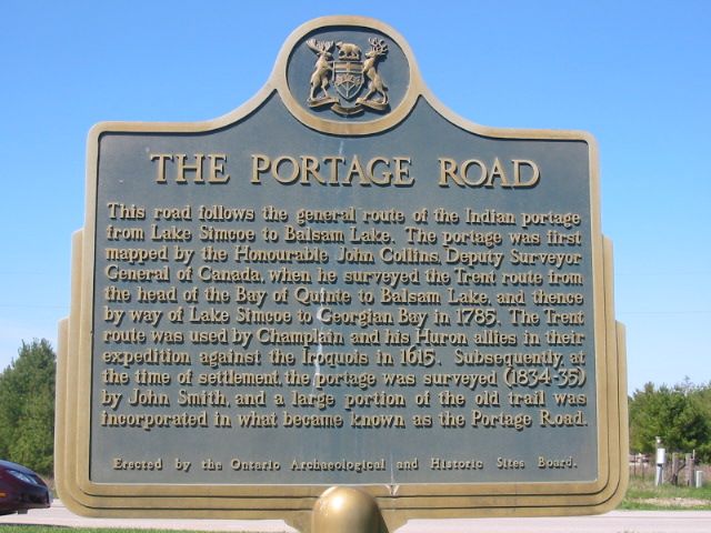
Photo by Alan L Brown - Posted December, 2010
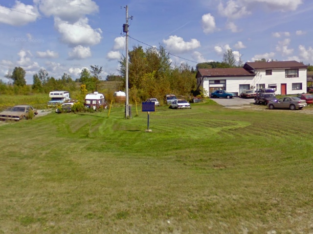
Photo from Google Street View ©2010 Google - Posted December, 2010
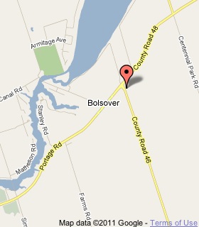
Plaque Location
The City of Kawartha Lakes
At the southeast corner of Road 48 and Road 46
Coordinates: N 44 31.947 W 79 03.284 |
 |
Plaque Text
This road follows the general route of the Indian portage from Lake Simcoe to Balsam Lake. The portage was first mapped by the Honourable John Collins, Deputy Surveyor General of Canada, when he surveyed the Trent route from the head of the Bay of Quinte to Balsam Lake and thence by way of Lake Simcoe to Georgian Bay in 1785. The Trent route was used by Champlain and his Huron allies in their expedition against the Iroquois in 1605. Subsequently, at the time of settlement, the portage was surveyed (1834-35) by John Smith, and a large portion of the old trail was incorporated in what became known as the Portage Road.
More
Roads
Here are the visitors' comments for this page.
(none yet)
Here's where you can sent me a comment for this page.
Note: Your email address will be posted at the end of your comment so others can respond to you unless you request otherwise.
Note: Comments are moderated. Yours will appear on this page within 24 hours (usually much sooner).
Note: As soon as I have posted your comment, a reply to your email will be sent informing you.
To send me your comment, click .
Thanks
Alan L Brown
Webmaster
Note: If you wish to send me a personal email, click .