Discover Ontario's history as told through its plaques
2004 - Now in our 13th Year - 2017
To see what's new on this site, you can visit the Home Page
Looking at this page on a smartphone?
For best viewing, hold your phone
in Landscape mode (Horizontal)
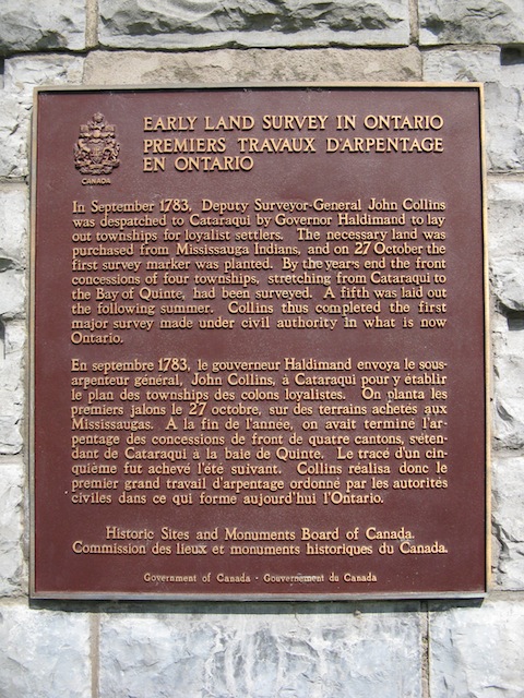
Early Land Survey in Ontario
Photos by contributor Wayne Adam - Posted December, 2009
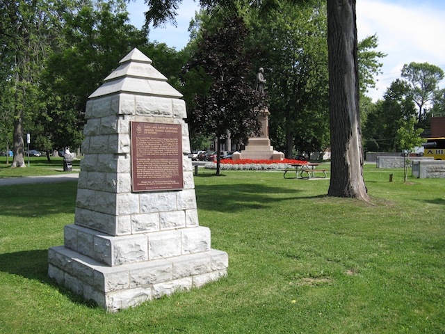
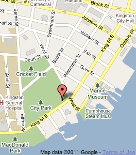
Plaque Location
The County of Frontenac
The City of Kingston
In a park on the north side of King Street East
just west of West Street
Coordinates: N 44 13.483 W 76 29.223 |
 |
Plaque Text
In September 1783, Deputy Surveyor-General John Collins was despatched to Cataraqui by Governor Haldimand to lay out townships for loyalist settlers. The necessary land was purchased from Mississauga Indians, and on 27 October the first survey marker was planted. By the year's end the front concessions of four townships, stretching from Cataraqui to the Bay of Quinte, had been surveyed. A fifth was laid out the following summer. Collins thus completed the first major survey made under civil authority in what is now Ontario.
Related Ontario plaques
United Empire Loyalists
The Crawford Purchase
More
Information
More
Surveyors
More
Kingston Plaques
Here are the visitors' comments for this page.
(none yet)
Here's where you can sent me a comment for this page.
Note: Your email address will be posted at the end of your comment so others can respond to you unless you request otherwise.
Note: Comments are moderated. Yours will appear on this page within 24 hours (usually much sooner).
Note: As soon as I have posted your comment, a reply to your email will be sent informing you.
To send me your comment, click .
Thanks
Alan L Brown
Webmaster
Note: If you wish to send me a personal email, click .