Discover Ontario's history as told through its plaques
2004 - Now in our 14th Year - 2018
To see what's new on this site, you can visit the Home Page
Looking at this page on a smartphone?
For best viewing, hold your phone
in Landscape mode (Horizontal)
The Founding of Stoney Point
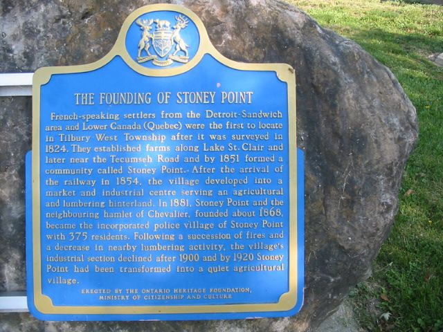
Photo by Alan L Brown - Posted September, 2004
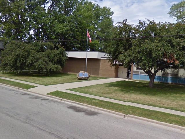
Photo from Google Street View ©2011 Google - Posted January, 2011
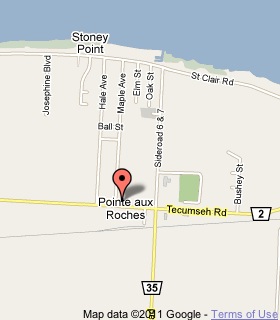
Plaque Location
The County of Essex
The Town of Lakeshore
On the north side of Tecumseh Road (Road 2),
1 block west of Comber Sideroad (Road 35)
Coordinates: N 42 18.310 W 82 33.068 |
 |
Plaque Text
French-speaking settlers from the Detroit-Sandwich area and Lower Canada (Quebec) were the first to locate in Tilbury West Township after it was surveyed in 1824. They established farms along Lake St. Clair and later near the Tecumseh Road and by 1851 formed a community called Stoney Point. After the arrival of the railway in 1854, the village developed into a market and industrial centre serving an agricultural and lumbering hinterland. In 1881, Stoney Point and the neighbouring hamlet of Chevalier, founded about 1868, became the incorporated police village of Stoney Point with 375 residents. Following a succession of fires and a decrease in nearby lumbering activity, the village's industrial section declined after 1900 and by 1920 Stoney Point had been transformed into a quiet agricultural village.
More
Information
More
Settlements
Here are the visitors' comments for this page.
> Posted July 27, 2018
Don't know if Stoney Point would equate to Rocky Point, but thought I would give it a try. In 1781, four Chippewa chiefs deeded 150 acres of land to 6 children of Antoine Louis Labadie. Antoine owned the farm which eventually was sold to Hiram Walker for his distillery in 1856. Two of the children were from his 1st wife and 4 of the children were from his 2nd wife, Marie, a Chippewa. My ancestor, Pierre, was from his 2nd marriage. The original document is in the Jo Labadie Special Collection at the University of Michigan. The land description follows: Beginning at Alexander and William Macombs line on the Rocky Point running thence to the entrance of the river La Franche (Thames) the whole one hundred fifty acres deep into the woods. The Detroit Historical Society advised that A and W Macomb owned land on both sides of the river at this time. I have no idea how long the Labadie children retained the property. Any information would be appreciated. Thank you.
Linn Hartman
> Posted January 30, 2011
I am trying to locate the family of Adolphe Desjardins & Pauline Renaud. Adolphe died June 11, 1959 & Pauline April 6,1954. Trying to locate other Desjardins decendents from Stoney Point.
Yours, Mr. Allen Desjardins, Lethbridge Alberta
Here's where you can sent me a comment for this page.
Note: Your email address will be posted at the end of your comment so others can respond to you unless you request otherwise.
Note: Comments are moderated. Yours will appear on this page within 24 hours (usually much sooner).
Note: As soon as I have posted your comment, a reply to your email will be sent informing you.
To send me your comment, click .
Thanks
Alan L Brown
Webmaster
Note: If you wish to send me a personal email, click .