Discover Ontario's history as told through its plaques
2004 - Now in our 13th Year - 2017
To see what's new on this site, you can visit the Home Page
Looking at this page on a smartphone?
For best viewing, hold your phone
in Landscape mode (Horizontal)
The Talbot Road
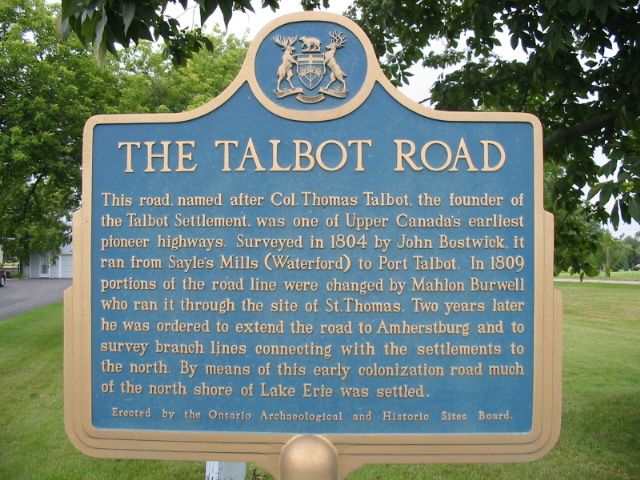
Photo by Alan L Brown - Posted August, 2004
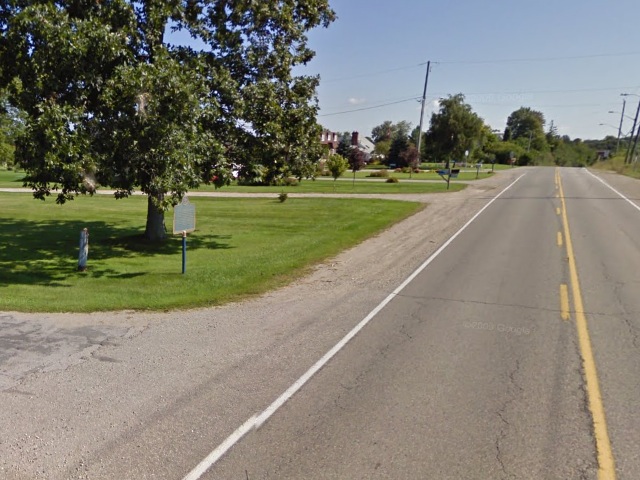
Photo from Google Street View ©2011 Google - Posted January, 2011
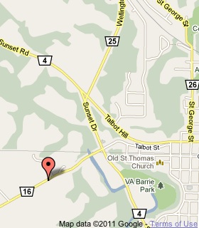
Plaque Location
The County of Elgin
The City of St. Thomas
On the north side of Fingall Line (Road 16)
630 m west of Road 4, street number 40012
Coordinates: N 42 46.541 W 81 13.141 |
 |
Plaque Text
This road, named after Col. Thomas Talbot, the founder of the Talbot Settlement, was one of Upper Canada's earliest pioneer highways. Surveyed in 1804 by John Bostwick, it ran from Sayle's Mills (Waterford) to Port Talbot. In 1809 portions of the road line were changed by Mahlon Burwell who ran it through the site of St. Thomas. Two years later he was ordered to extend the road to Amherstburg and to survey branch lines connecting with the settlements to the north. By means of this early colonization road much of the north shore of Lake Erie was settled.
Related Ontario plaques
The Talbot Settlement
Lieutenant-Colonel Mahlon Burwell 1783-1846
Colonel The Honourable Thomas Talbot 1771-1853
More
Information
More
Roads
Here are the visitors' comments for this page.
(none yet)
Here's where you can sent me a comment for this page.
Note: Your email address will be posted at the end of your comment so others can respond to you unless you request otherwise.
Note: Comments are moderated. Yours will appear on this page within 24 hours (usually much sooner).
Note: As soon as I have posted your comment, a reply to your email will be sent informing you.
To send me your comment, click .
Thanks
Alan L Brown
Webmaster
Note: If you wish to send me a personal email, click .