Discover Ontario's history as told through its plaques
2004 - Now in our 11th Year - 2015
To see what's new on this site, you can visit the Home Page
Philip Turnor ca. 1751-1800

Photo by contributor Parks Canada - Posted June, 2012
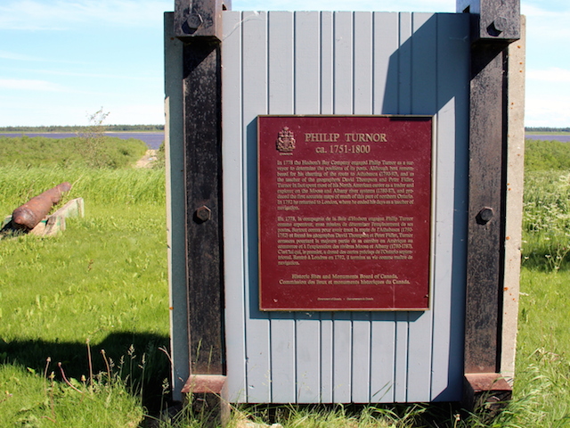
Photo by contributor Roger Taguchi - Posted July, 2014
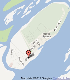
Plaque Location
The District of Cochrane
The Town of Moosonee
In Moose Factory
Coordinates: N 51 15.149 W80 36.333 |
 |
Plaque Text
In 1788 the Hudson's Bay Company engaged Philip Turnor as a surveyor to determine the positions of its posts. Although best remembered for his charting of the route to Athabasca (1790-92), and as a teacher of the geographers David Thompson and Peter Fidler, Turnor in fact spent most of his North American career as a trader and explorer on the Moose and Albany river systems (1780-87), and produced the first accurate maps of much of this part of northern Ontario. In 1792 he returned to London, where he ended his days as a teacher of navigation.
More
Information
More
Surveyors
More
Moosonee Plaques
Here are the visitors' comments for this page.
> Posted January 23, 2014
This appears to be the northernmost federal marker in Ontario, at a latitude of 51.25 degrees North.
-Wayne
Here's where you can sent me a comment for this page.
Note: If your comment includes a question, it's best to include your email address in your comment so others can respond to you.
Note: Comments are moderated. Yours will appear on this page within 24 hours (usually much sooner).
Note: As soon as I have posted your comment, a reply to your email will be sent informing you.
To send me your comment, click .
Thanks
Alan L Brown
Webmaster
Note: If you wish to send me a personal email, click the Email link in the Menu.