Discover Ontario's history as told through its plaques
2004 - Now in our 12th Year - 2016
To see what's new on this site, you can visit the Home Page
Looking at this page on a smartphone?
For best viewing, hold your phone
in Landscape mode (Horizontal)
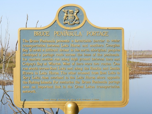
Bruce Peninsula Portage
Photos by contributor Wayne Adam - Posted October, 2011
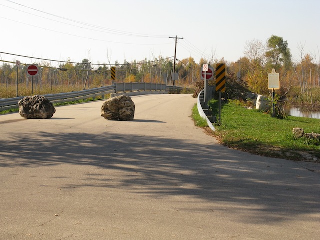
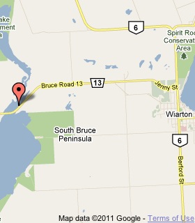
Plaque Location
The County of Bruce
The Town of South Bruce Peninsula
On Road 13, 6.5 km west of Highway 6 in Wiarton
on the shore of a lake at a parking area
on the north side of the road at street number 3209
Coordinates: N 44 44.671 W 81 13.190 |
 |
Plaque Text
The Bruce Peninsula presents a formidable barrier to water transportation between Lake Huron and southern Georgian Bay. To avoid a difficult detour to the north, aboriginal peoples developed a portage route across the base of the peninsula. Its eastern section ran along high ground between here and Colpoy's Bay at Wiarton. West of here were two routes. One ran south across Boat Lake and along the Rankin and Sauble Rivers to Lake Huron. The other crossed from Boat Lake to Spry Lake, then overland to the Lake Huron shore opposite the Fishing Islands. For centuries the Bruce Peninsula portage was an important link in the Great Lakes transportation network.
More
Portages
More
South Bruce Peninsula Plaques
Here are the visitors' comments for this page.
(none yet)
Here's where you can sent me a comment for this page.
Note: Your email address will be posted at the end of your comment so others can respond to you unless you request otherwise.
Note: Comments are moderated. Yours will appear on this page within 24 hours (usually much sooner).
Note: As soon as I have posted your comment, a reply to your email will be sent informing you.
To send me your comment, click .
Thanks
Alan L Brown
Webmaster
Note: If you wish to send me a personal email, click .