Ontario's Historical Plaques
at ontarioplaques.com
Learn a little Ontario history as told through its plaques
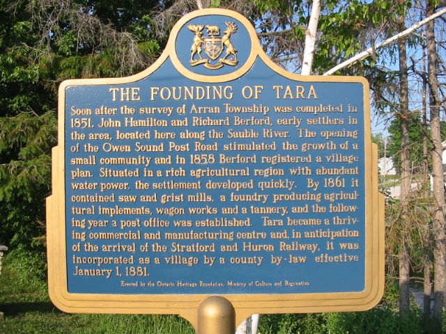
The Founding of Tara

Photo by Alan L Brown - Posted June, 2005

Photo from Google Street View ©2011 Google - Posted January, 2011
Plaque Location
The County of Bruce
The Municipality of Arran-Elderslie
In Tara, in a park on the
east side of Yonge Street South (Road 10)
at the north side of the bridge
Coordinates: N 44 28.738 W 81 08.748 |
 |
Plaque Text
Soon after the survey of Arran Township was completed in 1851. John Hamilton and Richard Berford, early settlers in the area, located here along the Sauble River. The opening of the Owen Sound Post road stimulated the growth of a small community and in 1858 Berford registered a village plan. Situated in a rich agricultural region with abundant water power, the settlement developed quickly. By 1861 it contained saw and grist mills, a foundry producing agricultural implements, wagon works and a tannery, and the following year a post office was established. Tara became a thriving commercial and manufacturing centre and, in anticipation of the arrival of the Stratford and Huron Railway, it was incorporated as a village by a county by-law effective January 1, 1881.
More
Information
More
Settlements
Here are the visitors' comments for this page.
(none yet)
Here's where you can write a comment for this page.
Note: If you wish to ask me a question, please use the email link in the menu.
Note: Comments are moderated. Yours will appear on this page within 24 hours
(usually much sooner).
Note: As soon as the comment is posted, a link to it will appear on the home page in the section "Here are the 10 latest plaque pages with a new comment added by a visitor to this site."