at ontarioplaques.com
Learn a little Ontario history as told through its plaques
Wellington County House of Industry and Refuge
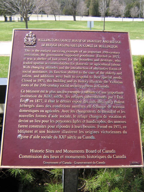
Photo by Alan L Brown - Posted May, 2009
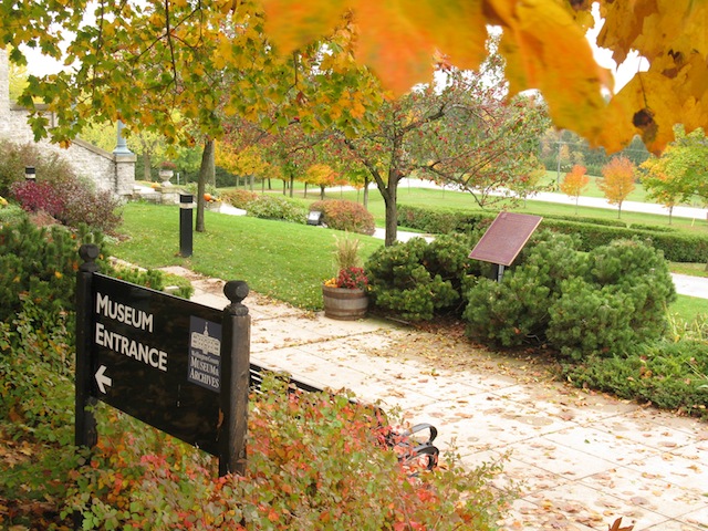
Photo by contributor Wayne Adam - Posted December, 2011
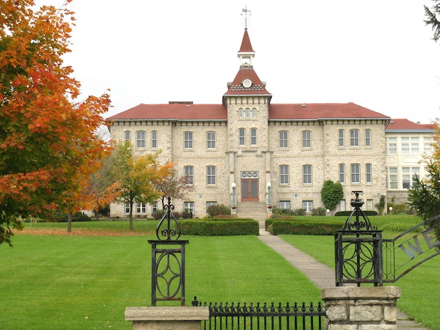
Photo by contributor Wayne Adam - Posted December, 2011
Plaque Location
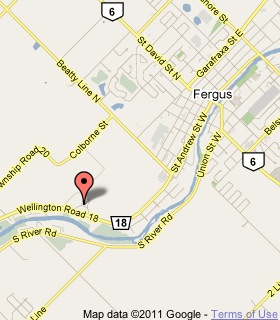
The County of Wellington
The Township of Centre Wellington
On County Road 18, street number 536
2.7 km west of Highway 6 in Fergus
in some bushes to the left of the building
now the Wellington County Museum and Archives
Coordinates: N 43 41.575 W 80 24.004 |
 |
Plaque Text
This is the earliest surviving example of an important 19th-century institution, the government-supported poorhouse. Erected in 1877, it was the shelter of last resort for the homeless and destitute, who traded spartan accommodations for domestic or agricultural labour. With changing attitudes and the introduction of alternative forms of social assistance, its function shifted to the care of the elderly and infirm, and additions were built to respond to their special needs. Closed in 1971, this building and its history illustrate the Victorian roots of the 20th-century social security system in Canada.
Related Toronto plaques
House of Industry
House of Providence
More
Information
Here are the visitors' comments for this page.
> Posted February 7, 2011
Responding to the previous note... The plaque doesn't say which government supported this, but I'd guess it was Ontario, not a local government, and that it was a center with a large catchment area, taking in the poor from cities as well. In a rural area, agricultural work was available, and conveniently removed from population centers, where the destitute would be unsightly.
I'd like to learn what "Victorian roots" means in this case, and why a foreign reference is applied to Canadian history. Did the roots of our social security system come from the U.K.? Did its development reflect a particularly British mindset? I would hope we would have developed our own system based on our own thoughts. Unless there's a specific historical reason not to, we'd do better to use our own names to relate national history: Confederation Era, Post-Confederation, or Macdonald Era. -Wayne
> Posted February 5, 2011
I wonder who the first inhabitants of this institution might have been? The surrounding community was largely made up of self sufficient dour Scots who were drawn together by their family and religeon and doubtless would be loath to take charity in that day and age. Its a very forward thinking group of community elders who would have devoted large resources to build this institution and there must have been some debate about its value.
Here's where you can write a comment for this page.
Note: If you wish to ask me a question, please use the email link in the menu.
Note: Comments are moderated. Yours will appear on this page within 24 hours
(usually much sooner).
Note: As soon as the comment is posted, a link to it will appear on the home page in the section "Here are the 10 latest plaque pages with a new comment added by a visitor to this site."