Ontario's Provincial Plaques
Here's where you can learn a little Ontario history.
Gateway to Huronia
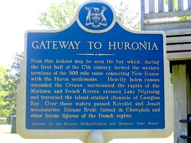
Photo by Alan L Brown - June 28, 2004
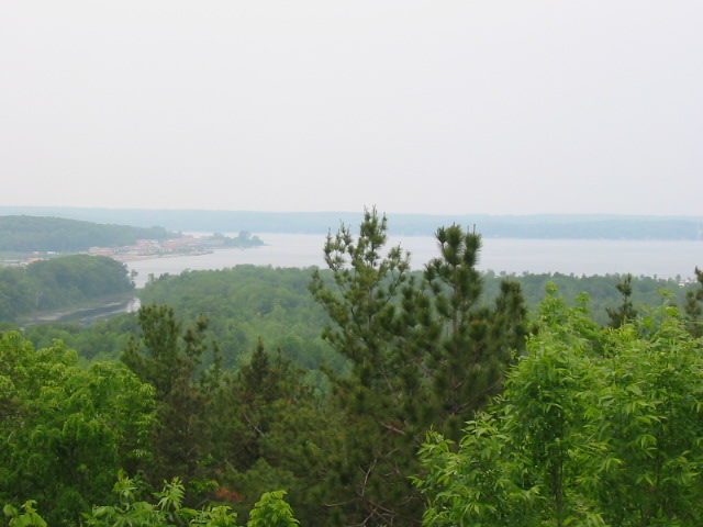
Photo by Alan L Brown - June 28, 2004
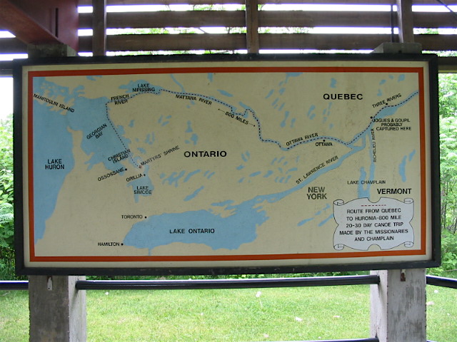
Photo by Alan L Brown - June 28, 2004
Plaque Location
The County of Simcoe
The Township of Tay
Beside a wooden lookout at the top of a hill at the Martyrs' Shrine on the north side of Highway 12 just east of the Wye River bridge
Plaque Text
From this lookout may be seen the bay which, during the first half of the 17th century, formed the western terminus of the 1280 km route connecting New France with the Huron settlements. Heavily laden canoes ascended the Ottawa, surmounted the rapids of the Mattawa and French Rivers, crossed Lake Nipissing and traversed the island-studded channels of Georgian Bay. Over these waters passed Récollet and Jesuit missionaries, Etienne Brulé, Samuel de Champlain and other heroic figures of the French regime.
Here's More
Waterways
Here are the comments for this page.
(none yet)
Write a comment for this page.
(Note: If you wish to ask me a question, please use the email link in the menu.)
Note: Comments are moderated. Yours will appear on this page within 24 hours (usually much sooner).