Ontario's Provincial Plaques
Here's where you can learn a little Ontario history.
Founding of St. Marys
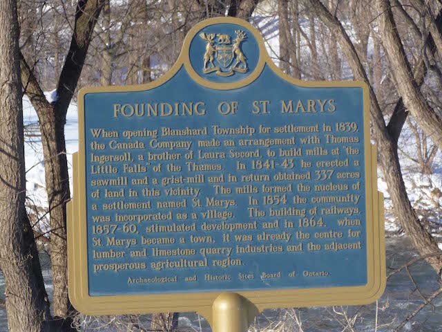
Photo by Alan L Brown - October 24, 2004
Plaque Location
The County of Perth
The Town of St. Marys
On the east side of the town hall on the NE corner of Queen Street and Church Street
Plaque Text
When opening Blanshard Township for settlement in 1839, the Canada Company made an arrangement with Thomas Ingersoll, a brother of Laura Secord, to build mills at "the Little Falls" of the Thames. In 1841-43 he erected a sawmill and a grist-mill and in return obtained 136 ha of land in this vicinity. The mills formed the nucleus of a settlement named St. Marys. In 1854 the community was incorporated as a village. The building of railways, 1857-60, stimulated development and in 1864, when St. Marys became a town, it was already the centre of lumber and limestone quarry industries and the adjacent prosperous agricultural region.
Here's More
Information
Here's More
Settlements
Here are the comments for this page.
(none yet)
Write a comment for this page.
(Note: If you wish to ask me a question, please use the email link in the menu.)
Note: Comments are moderated. Yours will appear on this page within 24 hours (usually much sooner).