Ontario's Historical Plaques
at ontarioplaques.com
Learn a little Ontario history as told through its plaques
The Trans-Canada Highway
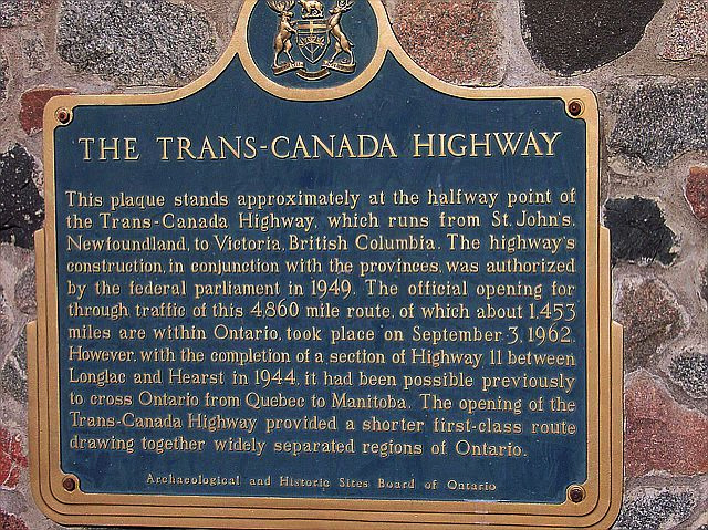
Photo by contributor Michael Kelly - Posted March, 2006
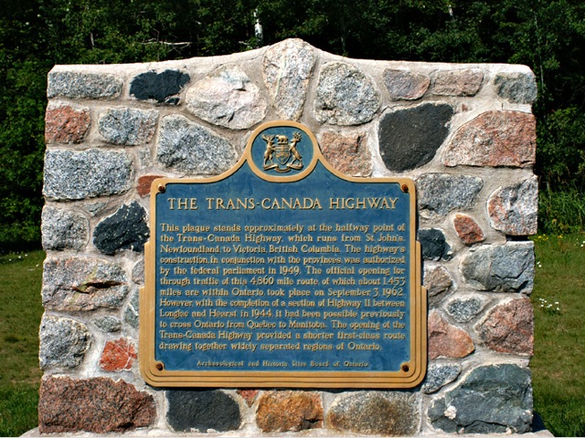
Photo by contributor George Sawyn - Posted July, 2007
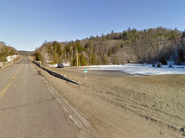
Photo from Google Street View ©2010 Google - Posted September, 2010
Plaque Location
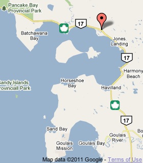
The District of Algoma
On Highway 17, at the south end of the bridge over the
Chippewa River, about 53 km north of Sault Ste. Marie
Coordinates: N 46 55.695 W 84 25.555 |
 |
Plaque Text
This plaque stands approximately at the halfway point of the Trans-Canada Highway, which runs from St. John's, Newfoundland, to Victoria, British Columbia. The highway's construction, in conjunction with the provinces, was authorized by the federal parliament in 1949. The official opening for through traffic of this 7,820 km route, of which about 2,338 km are within Ontario, took place on September 3, 1962. However, with the completion of a section of Highway 11 between Longlac and Hearst in 1944, it had been possible previously to cross Ontario from Quebec to Manitoba. The opening of the Trans-Canada Highway provided a shorter first-class route drawing together widely separated regions of Ontario.
More
Information
More
Roads
Here are the visitors' comments for this page.
Posted September 7, 2010
Visited on the Labour Day weekend. The plaque is missing from the stone cairn.
Here's where you can write a comment for this page.
Note: If you wish to ask me a question, please use the email link in the menu.
Note: Comments are moderated. Yours will appear on this page within 24 hours
(usually much sooner).