Discover Ontario's history as told through its plaques
2004 - Now in our 11th Year - 2015
To see what's new on this site, you can visit the Home Page
The Founding of Aylmer
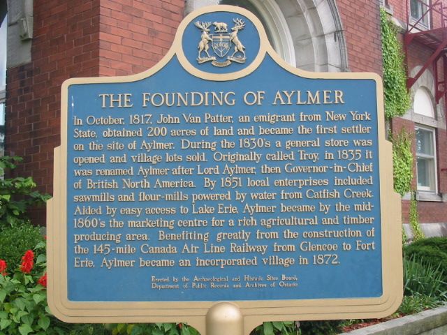
Photo by Alan L Brown - Posted August, 2004
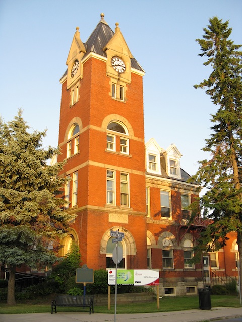
Photo by contributor Wayne Adam - Posted October, 2010
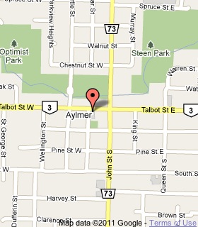
Plaque Location
The County of Elgin
The Town of Alymer
On the southeast corner of
Talbot Street (Road 3) and Centre Street
1 block west of John Street (Road 73)
Coordinates: N 42 46.372 W 80 59.045 |
 |
Plaque Text
In October 1817, John Van Patter, an emigrant from New York State, obtained 80 ha of land and became the first settler on the site of Aylmer. During the 1830's a general store was opened and village lots sold. Originally called Troy, in 1835 it was renamed Aylmer after Lord Aylmer, then Governor-in-Chief of British North America. By 1851 local enterprises included sawmills and flour-mills powered by water from Catfish Creek. Aided by easy access to Lake Erie, Aylmer became by the mid 1860's the marketing centre for a rich agricultural and timber producing area. Benefiting greatly from the construction of the 230 km Canada Air Line Railway from Glencoe to Fort Erie, Aylmer became an incorporated village in 1872.
More
Information
More
Settlements
Here are the visitors' comments for this page.
(none yet)
Here's where you can sent me a comment for this page.
Note: If your comment includes a question, it's best to include your email address in your comment so others can respond to you.
Note: Comments are moderated. Yours will appear on this page within 24 hours (usually much sooner).
Note: As soon as I have posted your comment, a reply to your email will be sent informing you.
To send me your comment, click .
Thanks
Alan L Brown
Webmaster
Note: If you wish to send me a personal email, click the Email link in the Menu.